 |
MITOrthoTools |
|||||||||||||||||||||||||||
| These extensions to popular GIS packages will let you import customized snippets of orthophotos from MITOrthoServers. | ||||||||||||||||||||||||||||
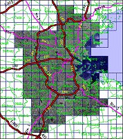
| Researchers in MIT's Urban Planning and Studies department have developed tools to facilitate networked access to geospatial data. Their goal is to use smart servers to provide customized snippets of digital orthophotos using just-in-time geoprocessing and interoperable web-based components. The MITOrthoTools
are extensions to popular GIS packages that import customized snippets
of digital orthophotos from MITOrthoServers over the Web
directly into your
mapping window.
|
||||||||||||||||||||||||||||


